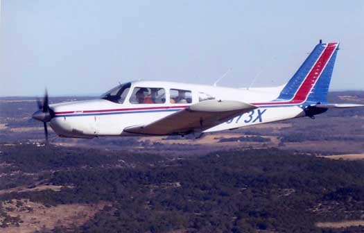
Our Piper Arrow
|
Our Piper Arrow |
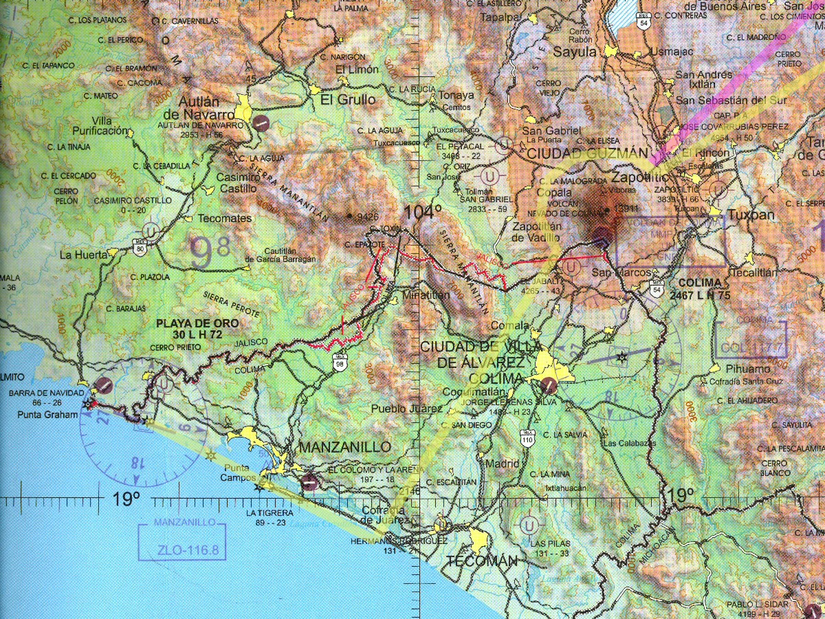
The first flight involved some stress in researching and complying with all the requirements for foreign flight. After having been through all that, the second flight was more relaxed and enjoyable. We took hundreds of photos on the first trip and more than 2000 on the second. Many of the photos were taken from the air and I made special flights to photograph about 2/3 of the Oaxacan coastline. See Photographing the Playas (Huatulco) and Photographing the Playas (Puerto Escondido). I plan to photograph the Jalisco and Colima coastline on this trip. See Photographing the Playas (Jalisco/Colima)
Airport of Entry to Mexico: On the first trip, I used Matamoros as the airport of entry. That did not work out so well because the airport was not expecting any more commercial flights that day so the immigration people had left and we had to wait for them to make a special trip back to the airport to issue our visas. Plus, some of the officials were located outside the airport in the airport tower area, while the immigration was located within the airport. We had to be escorted back and forth several times to complete the paperwork. On the second flight, which was essentially the same route, we used Tampico as the airport of entry. Tampico has all the offices inside the airport and they are staffed throughout the day, making this a much better choice. The procedure for entry involves visiting the various offices such as Airport Comandante, Immigration, Customs, and Airport Operations, in order to prepare the entry form, then re-visiting all of the offices to get the form stamped. We have typically found English-speaking personnel at the Airport Operations and Immigration offices but not so much at the other offices. The personnel have always been friendly and patient.
For this trip, Tampico is not on the route so we will use Monterrey as the airport of entry. The Monterrey airport is a large facility so I do not anticipate a problem with accessing the necessary offices for entry. Monterrey is easily within our range for a nonstop flight from central Texas.
Airport of Entry to the U.S.: On the first two trips we returned to the U.S. through Brownsville. For this trip, Laredo is a better choice for the route.
The Airplane
Flying a small airplane is generally not the cheapest way to get around but on our last trip with 3 people sharing expenses it was actually a little cheaper than flying commercial. Other positives are that we don't have to go through the security checks, don't pay extra for our bags, set our own schedule, don't have to get to the airport early, we park our cars in the hanger, don't have to go to the crowded part of the airport, and we don't worry about what we can or can't take aboard the plane. Once in the air, there is very little traffic. In Mexico there was almost no other general aviation traffic on our route to Oaxaca. I wonder why more people don't fly small airplanes.
Sectional Charts
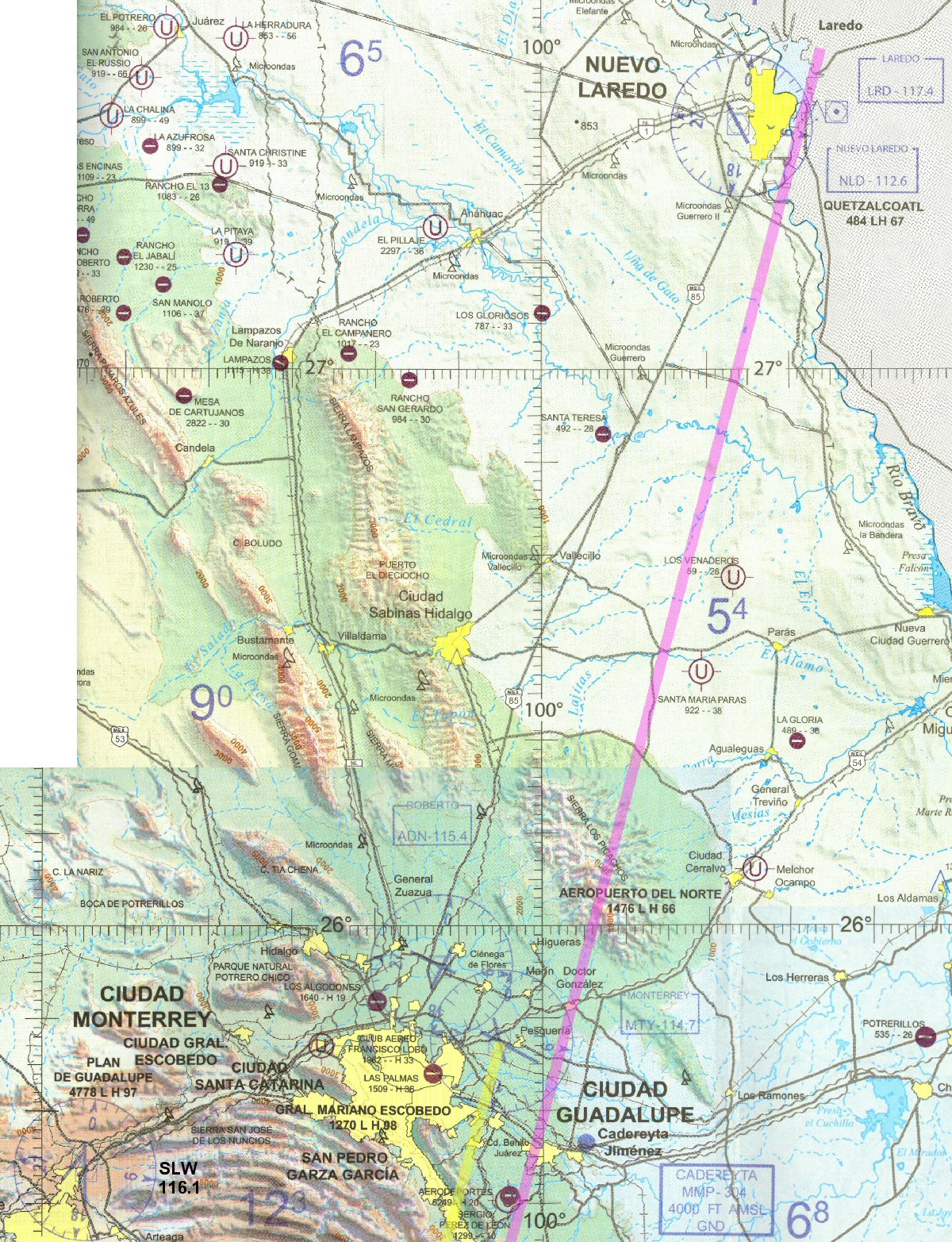
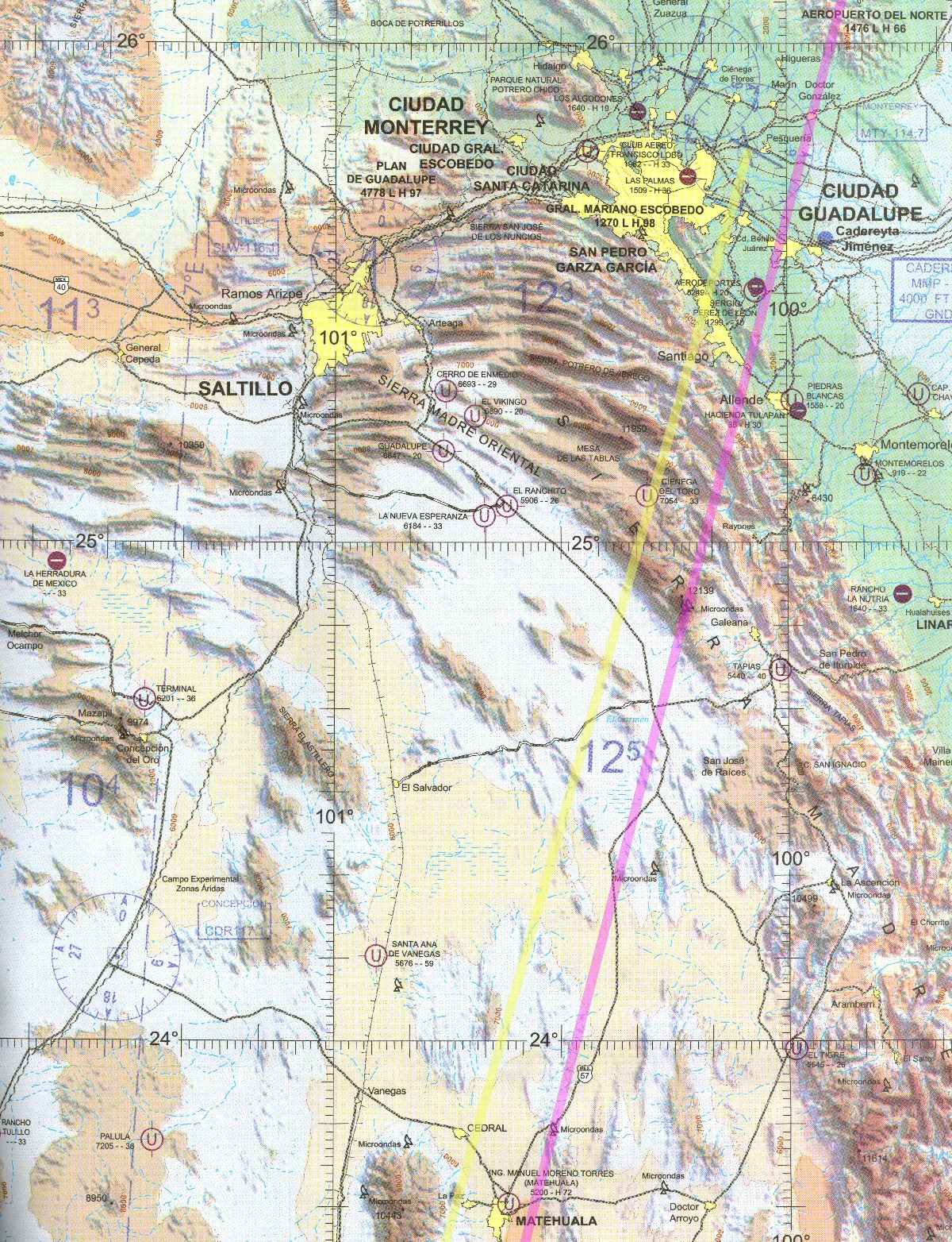
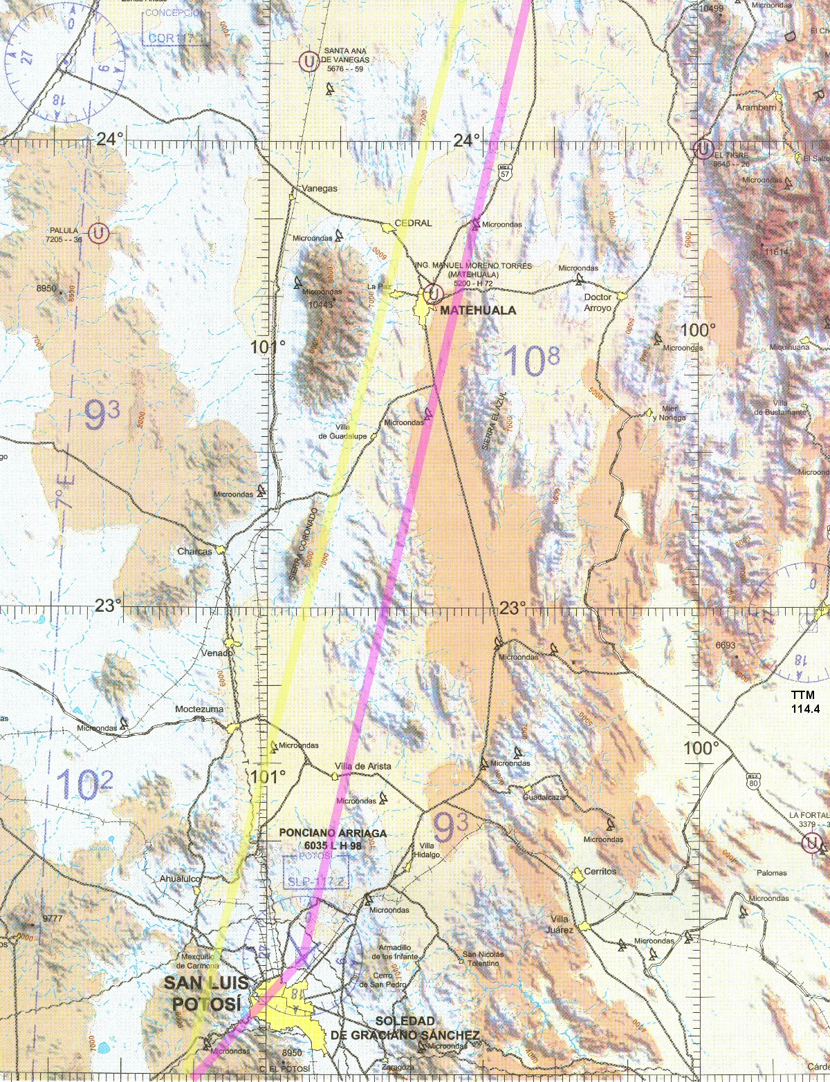
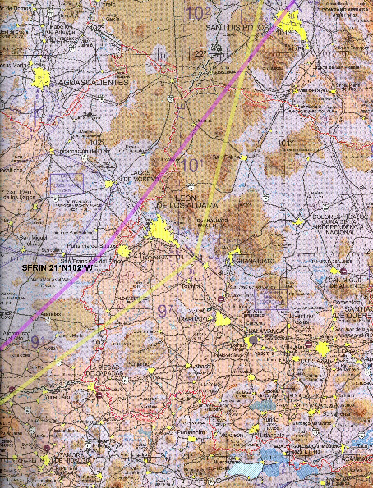
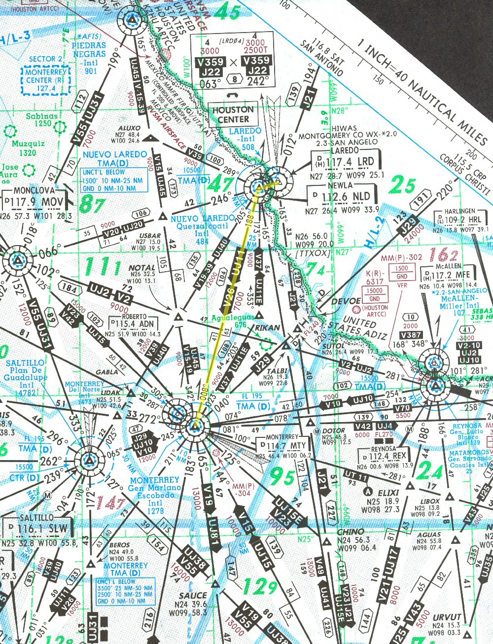
This year I find that there are now WAC (world aeronautical chart) charts available for parts of Mexico. These are like the sectional charts that we use in the U.S. but the scale only permits half the detail. That isn't a problem at all in Mexico because there are not so many aviation facilities. I ordered 2 WAC charts from Caribbean Sky Tours, MXWAC-MTY-NLR and MXWAC-GUA-CUL. The route of flight from WAC charts is shown at right. Yellow lines are southbound and purple lines are northbound.
|
|
Enroute Low Altitude Charts
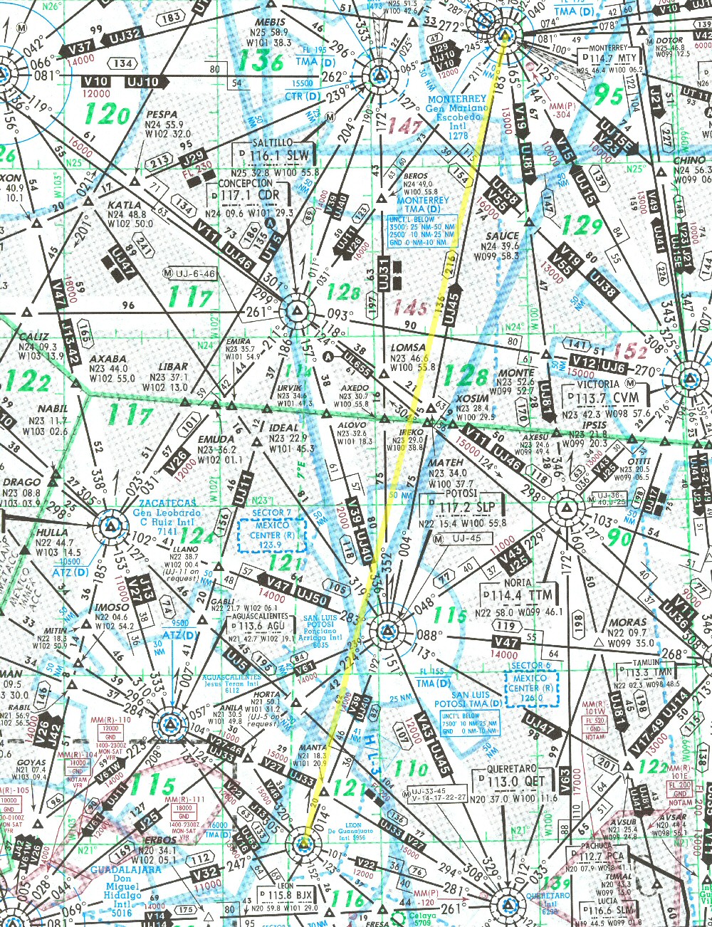
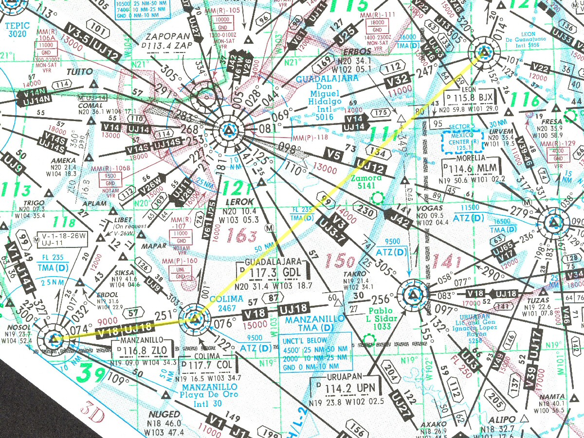
I purchased the Mexico travel kit from Jeppesen which includes all of the approach plates and enroute low altitude charts for Mexico at a cost of about US$100. The charts also contain the high altitude information and are called Latin America High/Low Altitude Enroute Charts or LA(H/L). Actually, all of Mexico is covered by two LA(H/L) charts numbers 1 and 2 and they are printed on the front and back of a single sheet of paper. The chart excerpts displayed at right show my route; I won't be keeping them up to date so they are not for your navigation.
|
|
Approach Plates
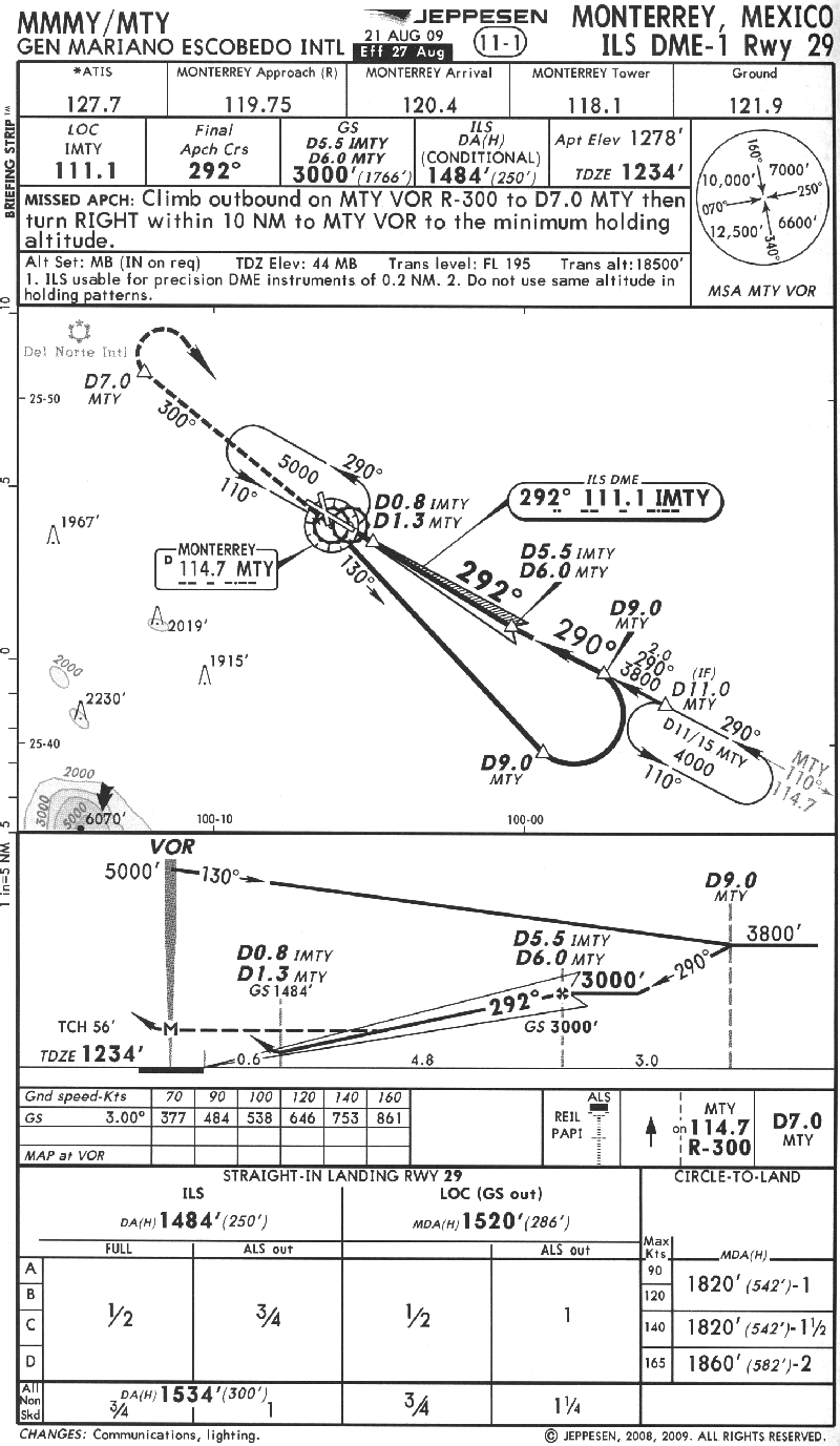
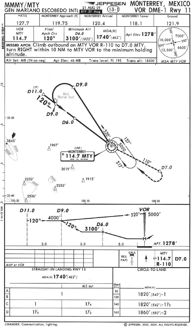
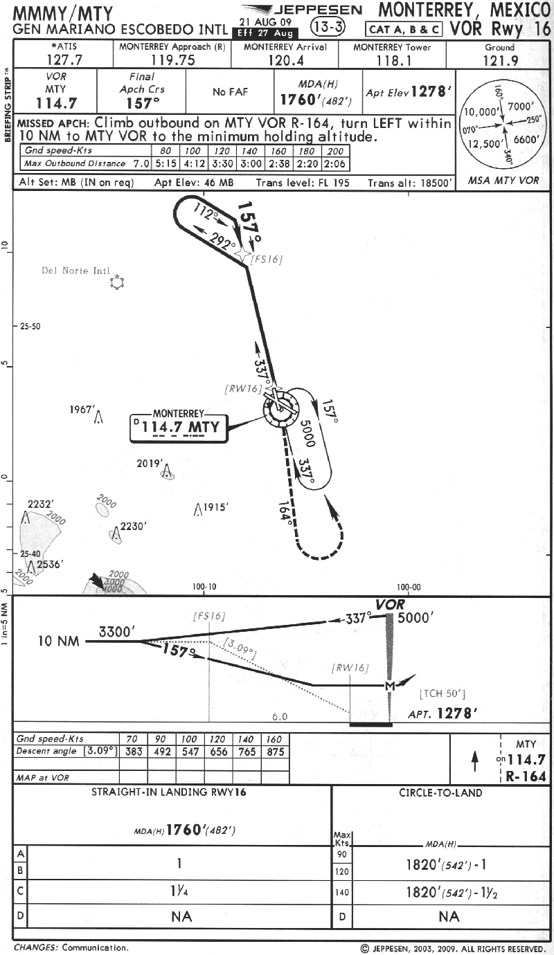
The ILS is the most precise approach, giving the pilot horizontal and vertical guidance at increasing resolution along the glideslope and in most cases can be flown to 200' from the ground in zero visibility. The DME is a radio that tells the pilot how far he is from a VOR radio station with a resolution of 1/10th of a mile. A VOR is a radio that tells the pilot on which compass bearing he is from the radio transmitter on the ground. "VOR" may refer either to the transmitter on the ground or the receiver in the air. In Mexico, each of the international airports has a VOR on the airport and there are not many that are not located at an airport. In the U.S., most of the VORs are not located at airports. Here are 3 of the many instrument approaches for Monterrey. Again, I am not keeping these approach plates up to date; they are just for whoever might be curious about such things.
|
|
Flight Plan
León is a little out of the way but it gets us around Guadalahara. There are large areas of restricted airspace around Guadalahara so it is impractical to fly in that area. The deviation will bring us close to Volcán Nevado de Colima so we'll take some photos of that.
On the return flight we will have to stop in Laredo for US Customs and there is no need to stop in Monterrey. So I moved the fuel stop further north to San Luis Potosi. My passenger will surrender her visa in San Luis Potosi (the pilot doesn't need one) and the Airport Comandante will collect the airplane permit.
eAPIS, the New Customs Requirement
This new requirement is not going to be convenient. I know of no plans for Mexican airports to provide internet access for departing pilots. I expect I will just have to file my return manifest before I enter Mexico and hope to still be on schedule when I return a week later.
Before departing I called Laredo Customs to make sure I had the right telephone number and to see if I should still make a phone call to announce my return from Mexico. They said I still needed to call at least an hour in advance of my return even though I was reporting my return using the eAPIS system. I did so and there was not a problem except for the unexpected closing of the airport for a dry run on the air traffic control system that was to be used at an airshow the following day. I just had to reduce my airspeed and then hold a couple of minutes upon arriving before landing.