OF
|
|
|
| Cacalotepec [cah cah LOW teh peck], Oaxaca [wah·HAH·cah] is a small beachfront community located 30 km west of Puerto Escondido. |
| Chacalapa [chah cah LAH pah], Oaxaca [wah·HAH·cah] is a small community located a few miles inland on Hwy 175 at the base of the Sierra Madre del Sur. |
| Huatulco [hwa·TOOL·co], Oaxaca [wah·HAH·cah] is Mexico's newest resort and is still relatively uncrowded and unspoiled. Its numerous small, isolated bays, or the Bahías de Huatulco, and close proximity to the mountainous jungles of the Sierra Madre del Sur make it an idyllic setting. The new Huatulco International airport 10 miles west of town serves the resort. |
| Mazunte [mah SOON·tay] is the home of the turtle museum. The turtles which come here to lay their eggs on the beach were once harvested but are now protected. The small beachfront community has turned to ecotourism.
|
|
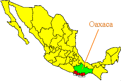
Oaxaca [wah HAH cah] is the capital of the state of Oaxaca. It is located in a high valley (5100') in the center of the state. The city is centered on its bustling, centuries old zócolo. Oaxaca is a city rich in architecture, culture, history, arts, crafts, and cuisine. Nearby communities include San Bartolo Coyotepec (pottery), San Martin Tilcajete (wood carvings), Ocotlán de Morelos (market and convent), and Santo Tomás Jalietza (weaving).
|
|
Pinotepa [pee no TAY pah] is a business and cultural center located somewhat inland on the coastal highway 200 about 30 miles from the western state border. The surrounding area is dominated by Mixtec, Amusgo, and Chatino Indian cultures.
|
|
Pochutla [poe CHOOT lah] is a business center located slightly inland on the coastal highway 200 at the junction of Hwy 175.
|
|
Puerto Angel [ANGH·hell] is a peaceful fishing village/tourist town situated in hilly terrain at the southernmost tip of Oaxaca; a good place for travelers on a budget to relax and get away from it all. The proximity of it's ritzy new neighbor, Huatulco, 35 miles to the east, has not spoiled this secluded spot. Nearby Zipolite is even less developed.
|
|
A popular retreat for hippie-types in the 60's and 70's, Puerto Escondido [ace·cone·DEE·doe] has blossomed into its own brand of tourist mecca. The beaches are as beautiful as ever, the surfing is world class, and there are more places to eat, stay, and shop. It has its own airport just west of town with service to Mexico City and Oaxaca City.
|
| Salina Cruz [sah LEE nah • cruse] is a port city on the Bay of Tehuantepec. It is primarily a business center for an oil-producing region but does offer some tourist attractions.
|
| Agustinillo [ah goose tee KNEE yo] is a small beachfront community near Mazunte. The beach area is characterized by rocky outcroppings jutting out of the water.
|
| San José del Pacífico is located high in the Sierra Madre del Sur, a 4-hour drive inland on Hwy 175. The town features pretty varnished wood buildings, spectacular scenery, a Día de San José (March 19) celebration, and psychedelic mushrooms.
|
| San Pedro Juchatengo [hoo·chah·TAIN·go], Oaxaca [wah·HAH·cah] is located along the Atoyac river on Hwy 131 105 km (65 miles) north of Puerto Escondido. |
| Playa Ventanilla [vain tah KNEE yah] is a small remote beachfront community west of Mazunte.
|
| [see·poe·LEE·tay]
This tiny town is a hangout for the young and the young at heart. If you don't need much more than a hammock on the beach and plenty of good food and refreshment, Zipolite can provide it. Very low prices on food and accommodations, no telephones, strong waves, nude beach, international visitors. |