Home >>
Transportation >>
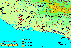
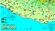
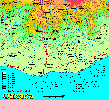
Highway 200
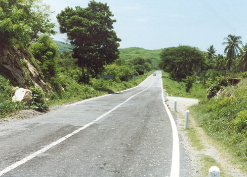
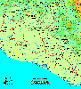
Highway 200 is the coastal highway or Carretera Costera. It runs near the Pacific coast from the state of Nayarit through Jalisco, Colima, Michoacán, Guerrero, Oaxaca, and Chiapas to the Guatemala border.
The highway is often damaged by heaving rains that may occur during the months of August - October. Maintenance workers will quickly make the road passable again since it is a lifeline to the coastal communities.
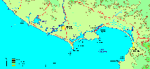
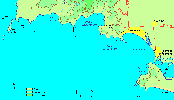
You can find the following locations along highway 200 (listed from west to east):
- Yelapa, Jalisco
- Careyes, Jalisco
- Playa Tecuán, Jalisco
- Tenacatita, Jalisco
- Boca de Iguanas, Jalisco
- La Manzanilla, Jalisco
- Cuastecomates, Jalisco
- Melaque, Jalisco
- Jaluco, Jalisco
- Barra de Navidad, Jalisco
- Colimilla, Jalisco
- Playa de Cocos
- La Huerta, Jalisco
- Cihuatlán, Jalisco
- Manzanillo, Colima
- Cuyutlan, Colima
- Playa Corralero
- Pinotepa Nacional, Oaxaca
- Santiago Jamiltepec
- Río Cacalotepec
- Cacalotepec, Oaxaca
- Manialtepec, Oaxaca
- Chila, Oaxaca
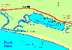
- Puerto Escondido Airport
- Puerto Escondido, Oaxaca
- Barra de Navidad Colotepec
- Río Tonameca
- Pochutla, Oaxaca
- La Crucecita, Oaxaca
- Santa Cruz, Oaxaca
- Huatulco, Oaxaca
- Río Copalita
- Salina Cruz, Oaxaca
| Top of page |
Main index |
Search |
What's new |
The Pacific Coast of Mexico
 www.tomzap.com
Tom Penick:
tom@tomzap.com
www.tomzap.com
Tom Penick:
tom@tomzap.com