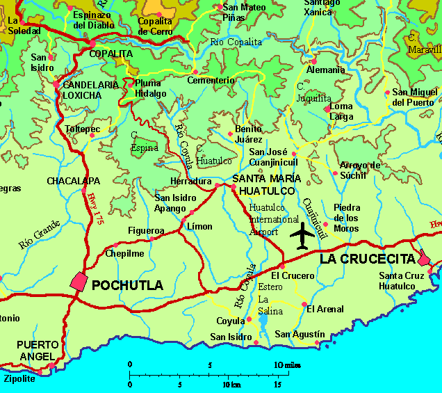
Pluma HidalgoGPS: 15°55.5'N 96°25.2'WElevation: 4265' (1300 meters)
| 
|
|
|
|
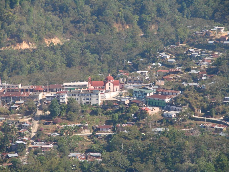
The altitude makes for pleasantly mild daytime temperatures and cool nights, requiring some warm clothing at night, in sharp contrast to the hot climate of the nearby coast. From its hillside perch on a clear day you can see the Pacific Ocean 15 miles away.
There is a new highway to Pluma Hidalgo, which makes access easy. The new highway is not seen on my city map as it is well to the east, but it is on the topographic map at right. I don't show street names on the city map, but there are no street signs anyway. The highway passes Pluma Hildalgo just to the east of town and a sharp right turnoff brings you in to town from the north. The highway intersects Hwy 200 just east of the Huatulco Airport. 10 km takes you first to Santa María Huatulco where you will take a 90° left just before the main road splits off in a "V" in town (see map). Stay on the pavement and follow the road out of town and across an interesting one-lane bridge and then up into the mountains for another 26 km (16 miles) to the Pluma Hidalgo turnoff. Mountain roads are damaged every year during the rainy season and it typically takes the remainder of the year to make repairs. Use caution when driving mountain roads and do not drive at night because washouts and landslides are usually unmarked.
See Aerial Photos of Pluma Hidalgo.
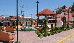
See Land Photos of Pluma Hidalgo.
Additional accommodations are available in Santa María Huatulco, 26 km down the mountain and in Huatulco, about 46 km away on the coast. Easter week and Christmas week are the busiest holiday periods and Mexico and hotels often fill up during these times.
| Help keep this information current. Email tom@tomzap.com with updates. |
Ayúdenme a mantener ésta información al día. Envía tus actualizaciones por e-mail a tom@tomzap.com.
|
| Help keep this information current. Email tom@tomzap.com with updates. |
Ayúdenme a mantener ésta información al día. Envía tus actualizaciones por e-mail a tom@tomzap.com.
|
| Help keep this information current. Email tom@tomzap.com with updates. |
Ayúdenme a mantener ésta información al día. Envía tus actualizaciones por e-mail a tom@tomzap.com.
|
| Help keep this information current. Email tom@tomzap.com with updates. |
Ayúdenme a mantener ésta información al día. Envía tus actualizaciones por e-mail a tom@tomzap.com.
|
| Help keep this information current. Email tom@tomzap.com with updates. |
Ayúdenme a mantener ésta información al día. Envía tus actualizaciones por e-mail a tom@tomzap.com.
|
| Help keep this information current. Email tom@tomzap.com with updates. |
Ayúdenme a mantener ésta información al día. Envía tus actualizaciones por e-mail a tom@tomzap.com.
|
| Help keep this information current. Email tom@tomzap.com with updates. |
Ayúdenme a mantener ésta información al día. Envía tus actualizaciones por e-mail a tom@tomzap.com.
|
| Help keep this information current. Email tom@tomzap.com with updates. |
Ayúdenme a mantener ésta información al día. Envía tus actualizaciones por e-mail a tom@tomzap.com.
|
|
|